---
title: Smart Maps for the UN and for All - keeping web maps open
tags: presentation
slideOptions:
theme: simple
slideNumber: c/t
---
## Smart Maps for the UN and for All - keeping web maps open
[](https://hackmd.io/@hfu/2023-06-29/edit)
2023-06-29 FOSS4G 2023
---
## Geospatial Support for the United Nations Operations
- **UN Secretariat** - UN Geospatial Information Section, UN Global Service Center
- **UN Open GIS Initiative** - a partnership initiative to identify and develop an Open Source GIS bundle that meets the requirement of UN operations
---
## UN Smart Maps Group
- The 7th Domain Working Group under UN Open GIS Initiative.
- Established in Firenze in August 2022.
- Vision: **keep web maps open for a better world**
- produce, host, style, optimize, UI,...
- Mission: **test new technoloies for future geospatial operations**
- https://unopengis.github.io/smartmaps
---
## UN Smart Maps Activities
1. **Smart Maps Assistant** <strike>MUNDO</strike>
2. **Smart Maps Bazaar** <strike>WebMaps3</strike>
3. Smart Maps Core
4. Smart Maps Documentation
5. UNVT Portable
6. And more. You can bring your projects or objectives!
---
## Smart Maps Assistant
by yuiseki
- yuiseki
- Product manager, Gyazo, Helpfeel Inc.
- Contributor of UN Open GIS, DWG-7, UN Smart Maps
---
### What I want to tell you
- Visualizing UN activities on the maps based on open data can enhance your understanding for UN!
- LLMs (Large Language Models), such as OpenAI, can be used powerfully in GIS!
---
### Overview of the Smart Maps Assistant
- Objective: To provide software that support **geospatial situation awareness** for humanity.
- Method: I developed **an AI Assistant** that interacts with humanity to understand the geospatial information being requested and build queries for the **Overpass API**.
---
### Capabilities of the Smart Maps Assistant
- Building a map to visualize multiple areas and multiple concerns.
- Building a map through conversation with AI Assistant.
---
### Demo of the Smart Maps Assistant
#### https://trident.yuiseki.net/
---
#### Demo, Case 1: **Visualizing UN Peacekeeping Operations**
- `Show Sudan and South Sudan.`
- `Show military installations.`
- `Show hospitals.`
- `Remove hospitals, then add shelters.`
- [Screenshots](https://gyazo.com/collections/646c85604655229379765ced0f06a100/list)
---
#### Demo, Case 2: **Visualizing interesting places in Prizren, Kosovo**
- We are now in Prizren, Kosovo...
- `Show Prizren, Kosovo.`
- At the morning you want to find a cafe for breakfast...
- `Show cafes.`
- At lunch, you want to look for burger shops...
- `Remove cafes, show only burger shops.`
- At dinner, you want to find a restaurant...
- `Remove burger shops, show only restaurants.`
- At midnight, you want to find a bar ...
- `Remove restaurants, show only bars.`
- [Screenshots](https://gyazo.com/collections/901ab2629e20b9139645edbdc1375c3e/list)
---
### Technology behind the Smart Maps Assistant
- **3-layer LLMs architecture** that has optimized to building Smart Maps
---
#### **1st: Surface Layer**
- LLM that responsible for natural interaction with humanity.
- Input: History of past interactions with humanity + new statements by users.
- Output: Natural text that responds to the humanity.
---
#### **2nd: Inner Layer**
- LLM that analyzes the interaction history between humans and Surface Layer and outputs **an intermediate language**.
- Input: Surface Layer and humanity's past interaction history.
- Output: Intermediate language that containing information necessary to generate Smart Maps.
---
#### **3rd: Deep Layer**
- LLM that outputs **an Overpass API query** based on **an intermediate language**.
- Input: An intermediate language output by the Inner Layer.
- Output: An Overpass API Query.
---
### Known issues and limitations of the Smart Maps Assistant
---
#### Because it is based on OpenStreetMap, it has the following limitations:
- OpenStreetMap data is not perfect.
- OpenStreetMap cannot handle **Temporary Concerns** like incidents, accidents and disasters.
---
#### Because it is still under development, it has the following limitations:
- If you keep interacting with it for too long, you'll get an error.
- If you specify the exact name of the building, the map generation will almost certainly fail.
---
### Future of the Smart Maps Assistant
- I want to be able to...
- handle Temporary Concerns.
- save and share the generated maps with the unique URL.
- visualize statistical geospatial information.
- have PostGIS SQL queries written, not just Overpass API queries.
---
### Conclusion of the Smart Maps Assistant
- If you are interested in integrating GIS with LLMs and other forms of AI, please talk to me.
- Let's share ideas!
- Thank you!
---
## Smart Maps Bazaar
---
// hfu's part
---
### LiDAR (3D Tiles)

https://github.com/optgeo/free-nagasaki-3dtiles
---
### Cadastre (PMTiles)
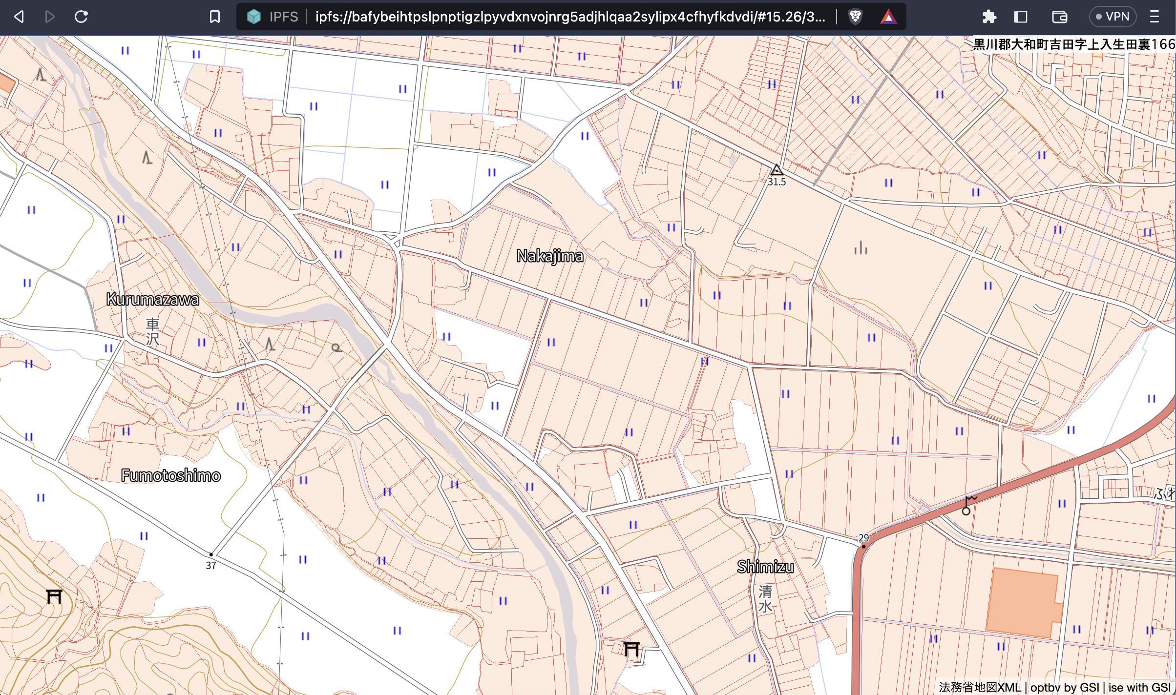
https://github.com/amx-project/ab
14GB PMTiles
---
### 3D City Model (3D Tiles)
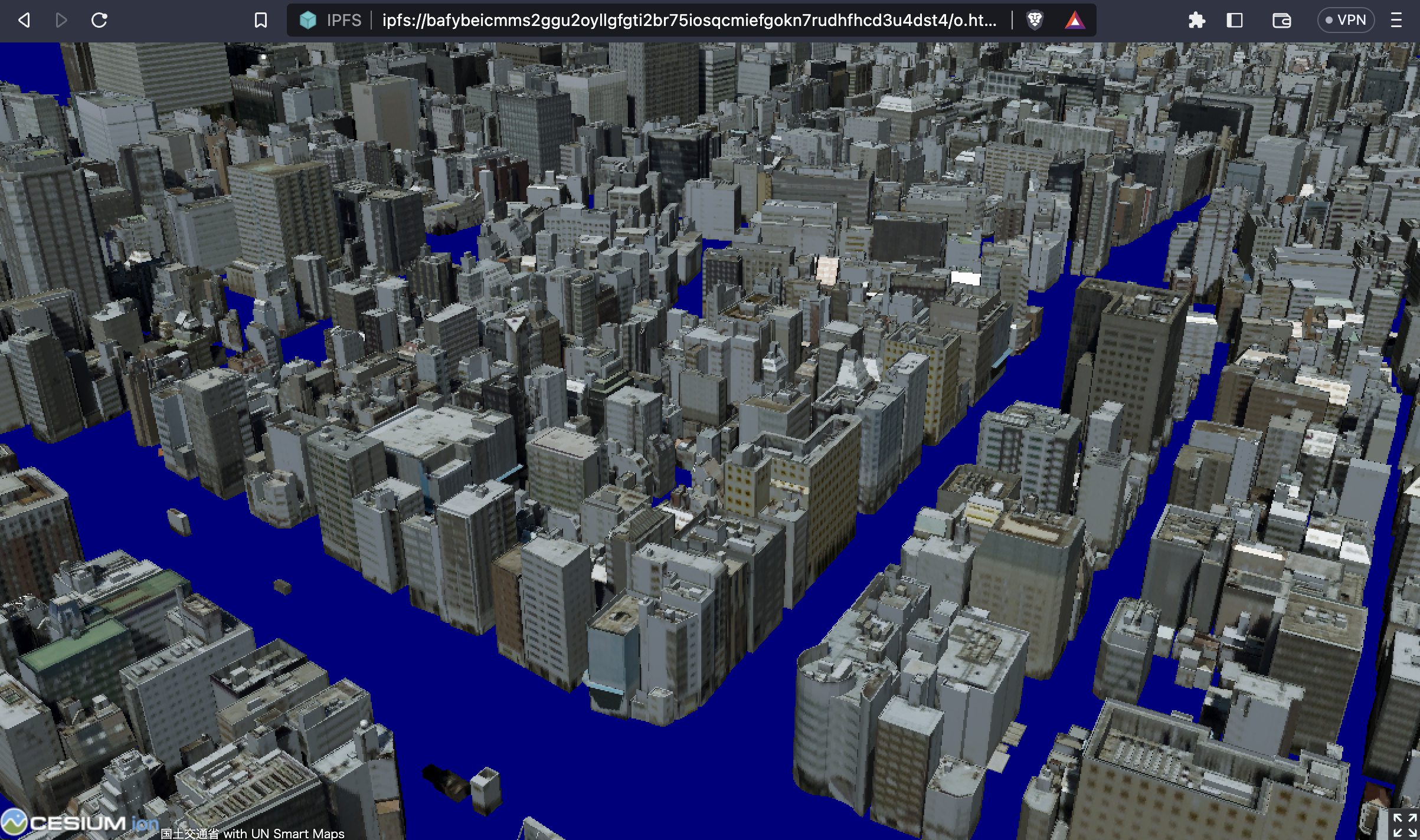
https://github.com/optgeo/platoon
---
## Smart Maps Core

---
## Smart Maps Documentation
---
## UNVT Portable
---
## Let's combine our efforts
https://unopengis.org/smartmaps
---
### Thank you

 Sign in with Wallet


