# EuroSAT
## Summary
* [Introduction](#introduction)
* [Dataset](#dataset)
* [Reference](#reference)
* [License](#license)
* [Citation](#citation)
## Introduction
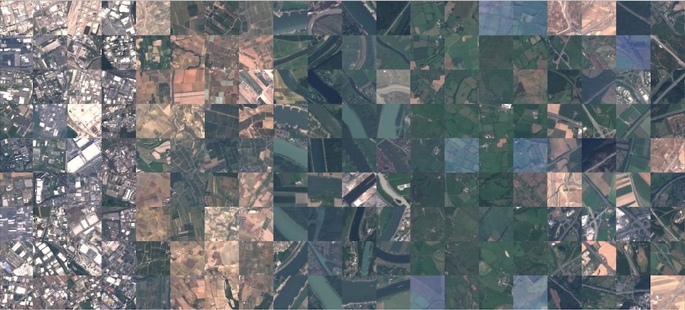
>In this study, we address the challenge of land use and land cover classification using Sentinel-2 satellite images. The Sentinel-2 satellite images are openly and freely accessible provided in the Earth observation program Copernicus. We present a novel dataset based on Sentinel-2 satellite images covering 13 spectral bands and consisting out of 10 classes with in total 27,000 labeled and geo-referenced images. We provide benchmarks for this novel dataset with its spectral bands using state-of-the-art deep Convolutional Neural Network (CNNs). With the proposed novel dataset, we achieved an overall classification accuracy of 98.57%. The resulting classification system opens a gate towards a number of Earth observation applications. We demonstrate how this classification system can be used for detecting land use and land cover changes and how it can assist in improving geographical maps. The geo-referenced dataset EuroSAT is made publicly available [here](https://github.com/phelber/EuroSAT).
## Dataset
The dataset is available via [Zenodo](https://zenodo.org/records/7711810#.ZAm3k-zMKEA).
**Deprecated Hosting**
* [EuroSAT Dataset (RGB)](https://zenodo.org/records/7711810#.ZAm3k-zMKEA)
* [EuroSAT Dataset (MS)](https://madm.dfki.de/files/sentinel/EuroSATallBands.zip)
### Data Fields
The dataset contains the following fields:
* `image`: An image in RGB format.
* `label`: The label for the image, which is one of 10 classes:
* 0: annual crop land
* 1: forest
* 2: brushland or shrubland
* 3: highway or road
* 4: industrial buildings or commercial buildings
* 5: pasture land
* 6: permanent crop land
* 7: residential buildings or homes or apartments
* 8: river
* 9: lake or sea
### Data Splits
The dataset contains the following splits:
* `train`: 21,600 examples
* `test`: 2,700 examples
* `contrast`: 2,700 examples
* `gaussian_noise`: 2,700 example
* `impulse_noise`: 2,700 examples
* `jpeg_compression`: 2,700 examples
* `motion_blur`: 2,700 examples
* `pixelate`: 2,700 examples
* `spatter`: 2,700 examples
*
## Reference
We would like to acknowledge Helber et al. for creating and maintaining the EuroSAT dataset as a valuable resource for the computer vision and machine learning research community. For more information about the EuroSAT dataset and its creator, please visit [the EuroSAT website](https://github.com/phelber/EuroSAT).
## License
The dataset has been released under the MIT license.
## Citation
```
@article{helber2019eurosat,
title={Eurosat: A novel dataset and deep learning benchmark for land use and land cover classification},
author={Helber, Patrick and Bischke, Benjamin and Dengel, Andreas and Borth, Damian},
journal={IEEE Journal of Selected Topics in Applied Earth Observations and Remote Sensing},
year={2019},
publisher={IEEE}
}
@inproceedings{helber2018introducing,
title={Introducing EuroSAT: A Novel Dataset and Deep Learning Benchmark for Land Use and Land Cover Classification},
author={Helber, Patrick and Bischke, Benjamin and Dengel, Andreas and Borth, Damian},
booktitle={IGARSS 2018-2018 IEEE International Geoscience and Remote Sensing Symposium},
pages={204--207},
year={2018},
organization={IEEE}
}
```
 Sign in with Wallet
Connect another wallet
Sign in with Wallet
Connect another wallet